
As the co-founder and former president of the Maryland Outdoor Club (established 2002; currently stagnant on leadership and events until volunteers step forward for both), and an avid outdoors person, it seems only fitting that I share with you my absolute favorite outdoor recreation spots in the Mid-Atlantic. Since my specific interests are in hiking, biking, flatwater paddling, and camping, that’s where I’ll focus.
Shortcut Menu:
- On Land (11)
- On Water (11)
- On Land & Water (2)
- Photography Disclaimer
These have been ordered, within each subhead, starting with my absolute favorite. But, you really can’t go wrong…they’re ALL favorites.
Important! Before venturing out to any of these locations, make sure you have your “ten” essentials, including: a map, emergency food, water, fire starter, whistle, first aid kit, and in the case of kayaking: PFD on your body, dry bag(s), waterproof 2-way radio, rescue devices, etc. Check the weather and water temperature to wear proper apparel. And, leave your location and contact information with a loved one at home. There are many outdoor retailers in and around Maryland (favs: REI, The Trail House, Wetsuit Wearhouse). Please consult with one to properly gear up before your adventure.
On Land
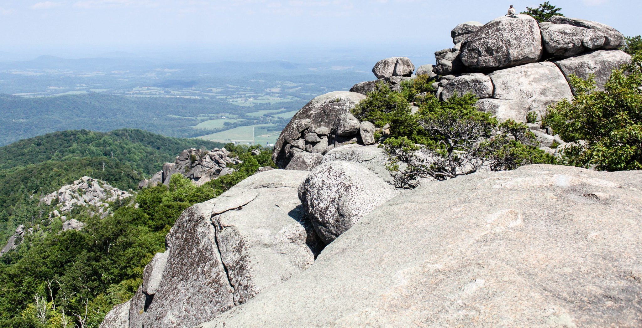
#1 Old Rag Mountain, Shenandoah National Park, Sperryville, VA
Location: SR 600 / Nethers Road, Sperryville, VA
Parking Coordinates: 38.57036, -78.28705
Parking: Limited (200 spots), fills up quickly on (popular) weekends, free
Type: Hike
Distance: 9 miles
Difficulty: Difficult
Synopsis: Old Rag Mountain is a popular hiking destination with a summit elevation of 3,291 feet, located in the Blue Ridge Mountains of the Shenandoah National Park in Virginia’s Madison County, near Sperryville. The trail can get very crowded in the late Fall, but having been there during all four seasons, I actually find the Winter the best time to go since it’s so peaceful at the summit and you’re not dealing with the heat of the sun on the exposed portions of the trail. I often say that a person of average hiking ability can complete this loop in about 6 hours: 2 hours to reach the start of the rock scramble, 2 hours to do the rock scramble (there are something like 4 “false” summits), 1 hour back down the mountain, and 1 hour on a gravel path back to the start of the hike. Take this into consideration when you’re planning what time to get started and where you want to be by lunchtime.
Fee: Per person Shenandoah National Park fee
Further Details: NPS.gov, NPS.gov Route Map, HikingUpward.com, AllTrails.com
#2 Billy Goat Trail, Section A, Carderock Recreational Area, Potomac, MD


Location: Parking Lot is directly ACROSS from Old Angler’s Inn, 10801 MacArthur Boulevard, Potomac, MD 20854 (and is a great after hike retreat)!
Parking Coordinates: 38.982294, -77.226147
Parking: Limited and shared with whitewater kayakers, rock climbers, and those enjoying the C&O Canal footpath, fills up quickly on weekends, free
Type: Hike
Distance: 4.8 miles
Difficulty: Difficult
Synopsis: The Billy Goat Trail is one of the most well known hikes in the Metro D.C. area, and for good reason. With nearly a mile of fun rock-hopping, and spectacular views of the Potomac River along the way, this circuit is loads of fun with plenty to see. From the parking lot, take the C&O Canal Towpath to the right, towards Great Falls. You can either continue forward to the Great Falls observation deck first or veer off onto Billy Goat Trail, Section A, when you approach it on the left, continuing up to the Great Falls scenic overlook following the trail. The mileage I’m quoting includes section A, Great Falls, and a closed loop by using the C&O Canal towpath. I’ve been here in Spring-Fall and can say I’ve seen BGT closed numerous times in the early Spring following heavy rainfall and/or moderate snow melt. The Potomac River will rise and temporarily wash out parts of the trail. Do your research before you go. I like to refer to this hike as the “rock scramble portion of Old Rag” (the hike above, in this list) without the elevation change (you’ll only be changing about 280 feet on this trail as opposed to 10x that on Old Rag).
Fee: No fee
Further Details: HikingUpward.com, AllTrails.com
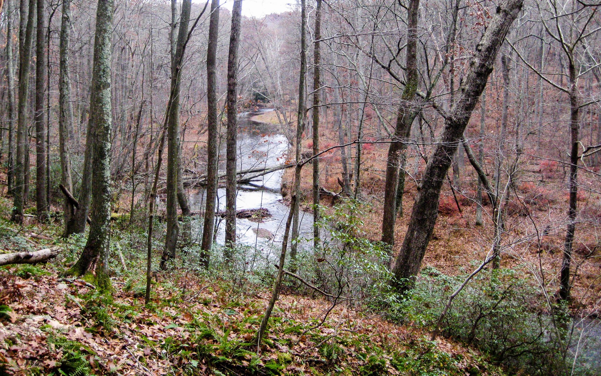
#3 Paw Paw Tunnel, C&O Canal Towpath, Oldtown, MD 21555


Location: C&O Canal Towpath, Oldtown, MD 21555
Parking Coordinates: 39.544379, -78.460829
Parking: Plenty of it, free
Type: Hike
Distance: 3.8 miles
Difficulty: Moderate (easy through the tunnel, steep over the tunnel)
Synopsis: Pack a flashlight or headlamp for this daytime hike – really! The Paw Paw Tunnel is a 3,118-foot-long (3/5ths of a mile) canal tunnel on the Chesapeake and Ohio Canal in Allegany County, Maryland. It’s a man made wonder that you just have to see up close to believe. Work began in June 1836 and lasted for 14 years. The tunnel eliminated 6 miles of canal, the Paw Paw Bends, but fell victim to bidirectional traffic and structure maintenance issues.
Fee: No fee
Further Details: NPS.gov, AllTrails.com
#4 Canyon Loop Trail, Swallow Falls State Park, Oakland, MD


Location: 2470 Maple Glade Road, Oakland, MD 21550
Parking Coordinates: 39.497099, -79.421183
Parking: Plenty of it, free
Type: Hike
Distance: 1.5 miles
Difficulty: Moderate
Synopsis: This trail system is regarded as one of the most scenic hikes in the area. 1.5-mile Canyon Loop Trail takes hikers along Muddy Creek Falls, highest in Maryland, Swallow Tails and scenic Swallow Falls as you travel next to the Youghiogheny River. Frequent rock outcroppings with wild rhododendron and mountain laurel are found along the trail. Handicap accessible trail to Muddy Creek Falls is also available. Side trip to Tolliver Falls offers a quieter side to the often crowded park trails.
Fee: Per person or per vehicle (in-state, out-of-state, time-of-year-dependent) DNR fee
Further Details: DNR.gov, GarrettTrails.org (Map)
#5 Mound Builder Trail (part of Little Bennett Loop), Little Bennett Regional Park, Clarksburg, MD


Location: 23705 Frederick Road, Clarksburg, MD 20871
Parking Coordinates: 39.256303, -77.287722
Parking: Plenty of it, free
Type: Hike
Distance: 4.1 miles
Difficulty: Easy
Synopsis: Spread over 3,700 acres, the park offers beautiful scenery, a large campground, a small playground, more than a dozen historic sites and over 25 miles of scenic natural surface trails. I love the “Little Bennett Loop” from David Lillard & Chris Reiter’s Hiking Maryland & Delaware (Second Edition / Third Edition) guide book. I only own the First Edition, so I can’t vouch if it’s in the later editions or not. It’s an easy Loop through several forest types that includes a pleasant stroll along Stoney Brook and Sopers Branch. The Loop consists of the Stoney Brook Trail, Mound Builder Trail (HUGE anthills – my favorite!), Bennett Ridge Trail, Woodcock Hollow Trail, Whitetail Trail, and the nature trail. Please pickup a copy of the book for the full write-up, map, etc.
Fee: No fee
Further Details: MontgomeryParks.org
#6 South Loop Trail, Gunpowder Falls State Park, Hereford Area, Parkton, MD
Location: 17910 York Road, Parkton, MD 21120
Parking Coordinates: 39.614018, -76.659248
Parking: Limited (extremely), free
Type: Hike
Distance: 4.2-9.6 miles (South Loop only -or- North and South Loop combined)
Difficulty: Moderate
Synopsis: A walk through the mixed hardwood and conifer woodlands along and above scenic Gunpowder Falls. The route I use is the “Gunpowder Falls North and South Loop” from David Lillard & Chris Reiter’s Hiking Maryland & Delaware (Second Edition / Third Edition) guide book. I only own the First Edition, so I can’t vouch if it’s in the later editions or not. I tend to just do the “South Loop” portion of the figure-8 hike, which crosses the parking lot mid-way. It utilizes the Gunpowder South Trail and the Panther Branch Trail to form a loop. Please pickup a copy of the book for the full write-up, map, etc. I used to pair this hike with a pitstop at Woodhall Winery immediately after (Hike ‘n Wine), but I see that Woodhall Winery is closed indefinitely, starting with mid-summer 2017. Do your research to see if they have decided to reopen or not…it’s a great little winery and I do hope they make a return!
Fee: No fee
Further Details: DNR.gov
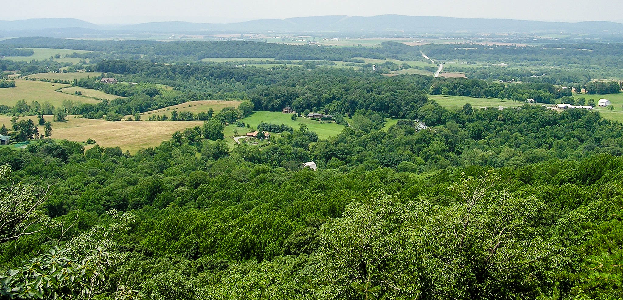
#7 Northern Peak Trail, Sugarloaf Mountain, Dickerson, MD
Location: East View Parking Lot, Sugarloaf Mountain, Dickerson, MD 20842
Parking Coordinates: 39.2605, -77.3903
Parking: Plenty of it, free
Type: Hike
Distance: 6.8 miles
Difficulty: Moderate
Synopsis: Sugarloaf Mountain is the prominence visible in the piedmont as it rises out of the plains southeast of Frederick, MD. The mountain and trails are maintained by Stronghold, Inc. a non-profit setup by Louise and Gordon Strong in 1946 to preserve the mountain so it could be enjoyed by everyone. The mountain has many wonderful hiking trails that can be combined to create many different loops. The hike linked below at HikingUpward.com is a 6.8-mile variation of the blue Northern Peak Trail loop.
Fee: No fee
Further Details: HikingUpward.com, SugarloafMd.com (Map), Patch.com Scenic Maryland Restaurants
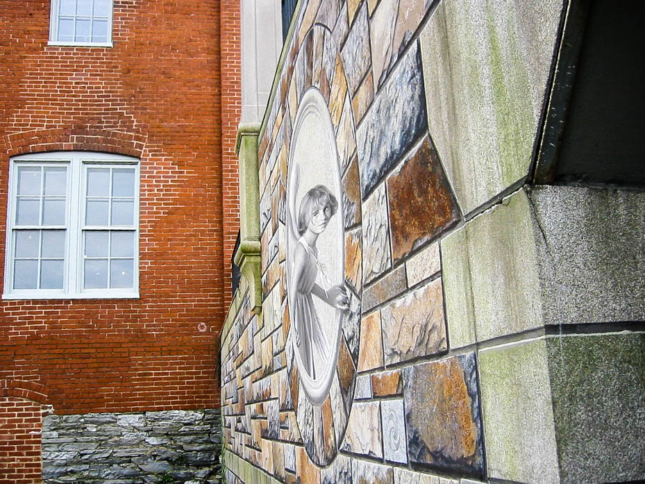
#8 Downtown, Historic Frederick, Maryland “City Hike”
Location: Baker Park Tennis Courts, College Avenue & West 2nd Street, Frederick, MD
Parking Coordinates: 39.416844, -77.418165
Parking: Street parking, free
Type: Hike
Distance: 5.25 miles
Difficulty: Easy
Synopsis: Urban “hike.” Explore several point-of-interest stops within this historic downtown. Perhaps pair it with lunch on Market Street or during the annual Fall In the Street festival.
Fee: No fee
Further Details: Saving-Amy.com
#9 Cash Lake Loop, Patuxent Research Refuge, Laurel, MD


Location: National Wildlife Visitor Center, 10901 Scarlet Tanager Loop, Laurel, MD 20708
Parking Coordinates: 39.026444, -76.798995
Parking: Plenty of it, free
Type: Hike
Distance: 4.7 miles
Difficulty: Easy
Synopsis: Established in 1936 by executive order of President Franklin D. Roosevelt, the Patuxent Research Refuge is the only National Wildlife Refuge in the United States established to support wildlife research. A walk through pine forests and near marshy lakes in an area that is arguably the wildest place within 75 miles of Washington, D.C. The route I use is the “Cash Lake Loop” from David Lillard & Chris Reiter’s Hiking Maryland & Delaware (Second Edition / Third Edition) guide book. I only own the First Edition, so I can’t vouch if it’s in the later editions or not. The Loop consists of the Laurel Trail, Valley Trail, Cash Lake Trail, Loop Trail, and Goose Pond. Because the area is managed for wildlife research, Zero Impact Hiking is especially important – no picknicking is allowed along the trail. Spring rains and/or heavy rains can occasionally make the south section of Cash Lake impassable, so do your research before you go. Please pickup a copy of the book for the full write-up, map, etc.
Fee: No fee
Further Details: FWS.gov
#10 Torrey C. Brown Rail Trail (NCR Trail), Sparks, MD


Location: NCR Trail Parking Lot, Sparks, MD (Paper Mill Road)
Parking Coordinates: 39.501547, -76.633633
Parking: Limited, free
Type: Bike (Run or Walk)
Distance: It’s out and back, so you choose! From Sparks to Monkton and back, you’re looking at about 14 miles roundtrip. You may want to go further past Monkton, though you’ll start to pick up slight elevation as you approach Pennsylvania. The trail is approximately 20 miles long in Maryland and another 20 miles into Pennsylvania.
Difficulty: Easy
Synopsis: Maryland’s Northern Central Railroad Trail (NCRR) extends 20 miles, stretching from Ashland Road in the Hunt Valley area to the state line. The trail is 10 feet wide with a stone dust surface. The most popular activities on the trail are hiking, running, bicycle riding, and horseback riding. The trail also provides access for fishing and tubing along the Gunpowder.
Fee: No fee
Further Details: NCRTrailSnails.com
#11 Baltimore-Washington International (BWI) Airport Bike Loop, Glen Burnie, MD


Location: Thomas A. Dixon Observation Area, 1911 Dorsey Road, Glen Burnie, MD 21061
Parking Coordinates: 39.162312, -76.66347
Parking: Limited and shared with families using the playground or observing the planes taking off / landing, fills up quickly following the workday in the warmer months, free
Type: Bike
Distance: 12.5 miles
Difficulty: Easy
Synopsis: The BWI Trail is a dedicated bike path around BWI airport offering a pleasant, 12.5-mile loop on paved asphalt. The rolling terrain runs through open field, woods, wetlands and of course offers views of the BWI airport. The trail is suitable for any type of road, mountain, and hybrid bicycle in good working condition.
Fee: No fee
Further Details: MapMyRide.com, AllTrails.com, 2012 YouTube Video, BWIAirport.com (Bike Rental Information)
On Water
#1 Nanjemoy, MD & Purse State Park
Put-in: Mallows Bay Boat Ramp


Location: 1440 Wilson Landing Road, Nanjemoy, MD 20662
Parking Coordinates: 38.467879, -77.262603
Parking: Plenty of it, free
Distance: 6~ miles (or less if you don’t like my suggested route)
Difficulty: Moderate (chop)
Synopsis: Mallows Bay is a small bay on the Maryland side of the Potomac River in Charles County, Maryland. The bay is the location of what is regarded as the “largest shipwreck fleet in the Western Hemisphere” and is described as a “ship graveyard.” You’ll want to keep an eye on the tides here, as it’ll help you know when is best to navigate through the ghost fleet. The shallower the water, the more likely you’ll get stuck. I tend to start off heading left from the boat dock, south on the Potomac River, past the abandoned ferry, Liverpool Point, across Blue Bay, past Douglas Point, before turning left again to land on the beachy shore near Purse State Park. In about 30 minutes time on the shore, you’ll end up finding approximately two dozen ancient shark teeth, by quickly sifting the sand. Stay even longer to find more! It’s a great place to pop out a chair and relax for lunch too. Once done taking a break, I head back, retracing my steps, and then finish by exploring the ghost fleet and returning to shore. I’ve put a map in the slideshow for this particular route. The reason this one is my absolute favorite Mid-Atlantic place to kayak? It’s simple: a) ancient shark teeth! and b) ghost fleet. No where else will you get both of these.
Fee: No fee
Further Details: NOAA.gov, DNR.gov, CNN.com, AtlanticKayak.com
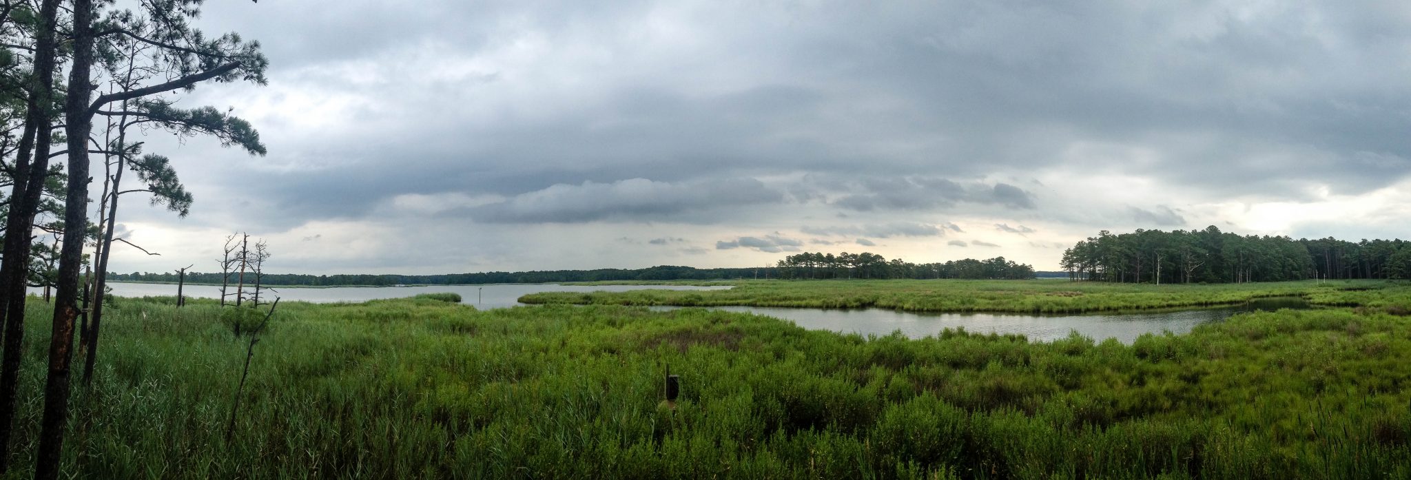
#2 Crisfield, MD
Put-in: Janes Island State Park* Boat Ramp


Location: 26280 Alfred J. Lawson Drive, Crisfield, MD 21817, USA
Parking Coordinates: 38.010837, -75.847875
Parking: Plenty of it, free
Distance: Varies
Difficulty: Easy-Moderate (chop)
Synopsis: Over 2,900 acres of saltmarsh, over 30 miles of water trails, and miles of isolated pristine beaches. Although people have harvested the resources of the island for thousands of years, today the island is wild and seemingly untouched. A haven for birds, fish, crabs, and other saltmarsh dwellers, Janes Island provides visitors a tranquil setting to explore the wildlife of the Bay while enjoying the expansive vistas and stunningly beautiful sunsets. Whether fishing or crabbing, motor boating or paddling, or simply relaxing, visitors to Janes Island will experience a world still ruled by the weather, the tides, and the wildlife that first drew people to this very special place. I’ve included two sample route maps in this location’s slideshow, but there are many, many different routes you can combine. If you’re looking for a lazy day, simply stick to the canal or head to the beach by kayak, out and back. I also highly recommend the mainland / car camping at JISP (select tent sites are dog-friendly). I believe they have back-country decks to camp on, but they are pack-in & -out (EVERYTHING, if you know what I mean). Consider going during the annual National Hard Crab Derby in Crisfield, MD as there will be a carnival in town, lots to see and do. Also, if seafood is your thing: Capt. Tyler’s Crabhouse is rated nearly 5 stars on Google, has a large, covered outdoor patio allowing you to feast on your crabs right on the water. Kayak / canoe rentals are available at the JISP park store during peak season.
Fee: Nominal boat launch DNR fee
Further Details: DNR.gov (Bandana Map), KayakCrisfield.com (Rentals)
#3 Scotland, MD
Put-in: Point Lookout State Park* Camp Store Boat Ramp


Location: 11175 Point Lookout Road, Scotland, MD 20687
Parking Coordinates: 38.05271, -76.32585
Parking: Plenty of it, free
Distance: Varies
Difficulty: Moderate (chop)
Synopsis: This park’s peaceful surroundings belie its history as the location of a prison camp which imprisoned as many as 52,264 Confederate soldiers during the Civil War. A museum on site recounts this vivid history. The Point Lookout Lighthouse is also opened sporadically in the month for guests to come explore. They have designated off-leash dog beaches, swimming beaches, fishing, hiking trails, and so much more. The car camping / cabins here are absolutely wonderful, dog-friendly and electric (select tent sites), and the camp loops each have piers. You can stick to Lake Conoy, Point Lookout Creek, or venture out into the Potomac River, so distance and difficulty is entirely up to you. A park map is available at park headquarters, the camp office, camp store, and the Civil War Museum/Marshland Nature Center. Adjacent to the camp store is a soft-launch for kayaks, a small beach. I have often seen sea nettles here in the warmer months, so be careful to wade in the launch area! Inquire with the park directly regarding kayak rentals.
Fee: Nominal per vehicle (in-state & out-of-state) DNR fee
Further Details: DNR.gov (Map)
#4 Sykesville, MD
Put-in: Piney Run Park Boat Ramp


Location: 30 Martz Road, Sykesville, MD 21784
Parking Coordinates: 39.397927, -76.98771
Parking: Plenty of it, free
Distance: Varies
Difficulty: Easy (lake)
Synopsis: Piney Run Park is a nature park in Sykesville, Carroll County, Maryland. The park encompasses 550 acres of fields, forest and open spaces, features over 5 miles of hiking trails, a 300 acre lake and many sports and recreational facilities. One of my favorite aspects of paddling here is that there are designated picnic areas only reachable by boat, scattered throughout the park. I also love to explore the never-ending lily pads. The lake is small enough, you’ll always have a sense of your bearings and never be terribly far away from help, should you need it. Canoes, kayaks, and row boats available for rental at the Park Boat House. Swimming is in designated areas only.
Fee: Per vehicle and boat launch (in-county & out-of-county) CC Parks fee
Further Details: CCGovernment.org
#5 Grasonville, MD
Put-in: Chesapeake Bay Environmental Center (Soft) Boat Launch
Location: 600 Discovery Lane, Grasonville, MD 21638
Parking Coordinates: 38.947401, -76.22904
Parking: Plenty of it, free
Distance: Varies
Difficulty: Moderate (hop)
Synopsis: With an ideal location on a peninsula, CBEC offers visitors the opportunity to glide around Marshy Creek, the Narrows and Prospect Bay viewing wading birds, waterfowl, and acres of marsh and restored shoreline. Really nice, relatively private, small landing beaches to have your picnic lunch, wade or swim in the water (no lifeguard present). They offer instructor-led kayak outings for those who prefer a guide or additional instruction.
Fee: CBEC membership fee
Further Details: BayRestoration.org (Kayak Rentals), Patch.com Scenic Maryland Restaurants
#6 Triadelphia Reservoir, Brookeville, MD (Montgomery County) & Dayton, MD (Howard County)
Put-ins: Big Branch (HoCo), Greenbridge (MoCo), Pigtail (HoCo), Triadelphia (MoCo)


Location: Greenbridge Recreation Area, 310 Greenbridge Road, Brookeville, MD 20833 (Multiple others in the WSSC Map, linked below)
Parking Coordinates: 39.198883, -77.013184
Parking: Limited, free
Distance: Varies
Difficulty: Easy (lake)
Synopsis: Triadelphia Reservoir is located on the Patuxent River, in Howard County and Montgomery County, Maryland near the town of Brookeville. The reservoir was created in 1943 by the construction of the Brighton Dam on the Patuxent. The reservoir is approximately 800 acres with an average depth of 52 ft. Study your map well based on the specific put-in location that you use. You may want to paddle to another put-in to have a pitstop for lunch or R&R. No swimming permitted.
Fee: Seasonal or single day watershed use WSSC permits (for those who live close by, the seasonal pass is a great buy)
Further Details: WSSCWater.com (Map)
#7 T. Howard Duckett Reservoir (Rocky Gorge), Silver Spring & Laurel, MD
Put-ins: Brown’s Bridge (Silver Spring), Scott’s Cove (Laurel), Supplee Lane (Laurel)


Location: Scott’s Cove, 11004 Harding Road, Laurel, MD 20723 (Multiple others in the WSSC Map, linked below)
Parking Coordinates: 39.134521, -76.891487
Parking: Limited, free
Distance: Varies
Difficulty: Easy (lake)
Synopsis: Rocky Gorge Reservoir is located on the Patuxent River in Howard County, Montgomery County and Prince George’s County, Maryland near the town of Burtonsville. The reservoir is approximately 775 acres with an average depth of 74 ft. Study your map well based on the specific put-in location that you use. You may want to paddle to another put-in to have a pitstop for lunch or R&R. No swimming permitted.
Fee: Seasonal or single day watershed use WSSC permits (for those who live close by, the seasonal pass is a great buy)
Further Details: WSSCWater.com (Map), PaxRiverKeeper.org (Kayak Rentals), PatuxentWaterTrail.org: Brown’s Bridge, Scott’s Cove
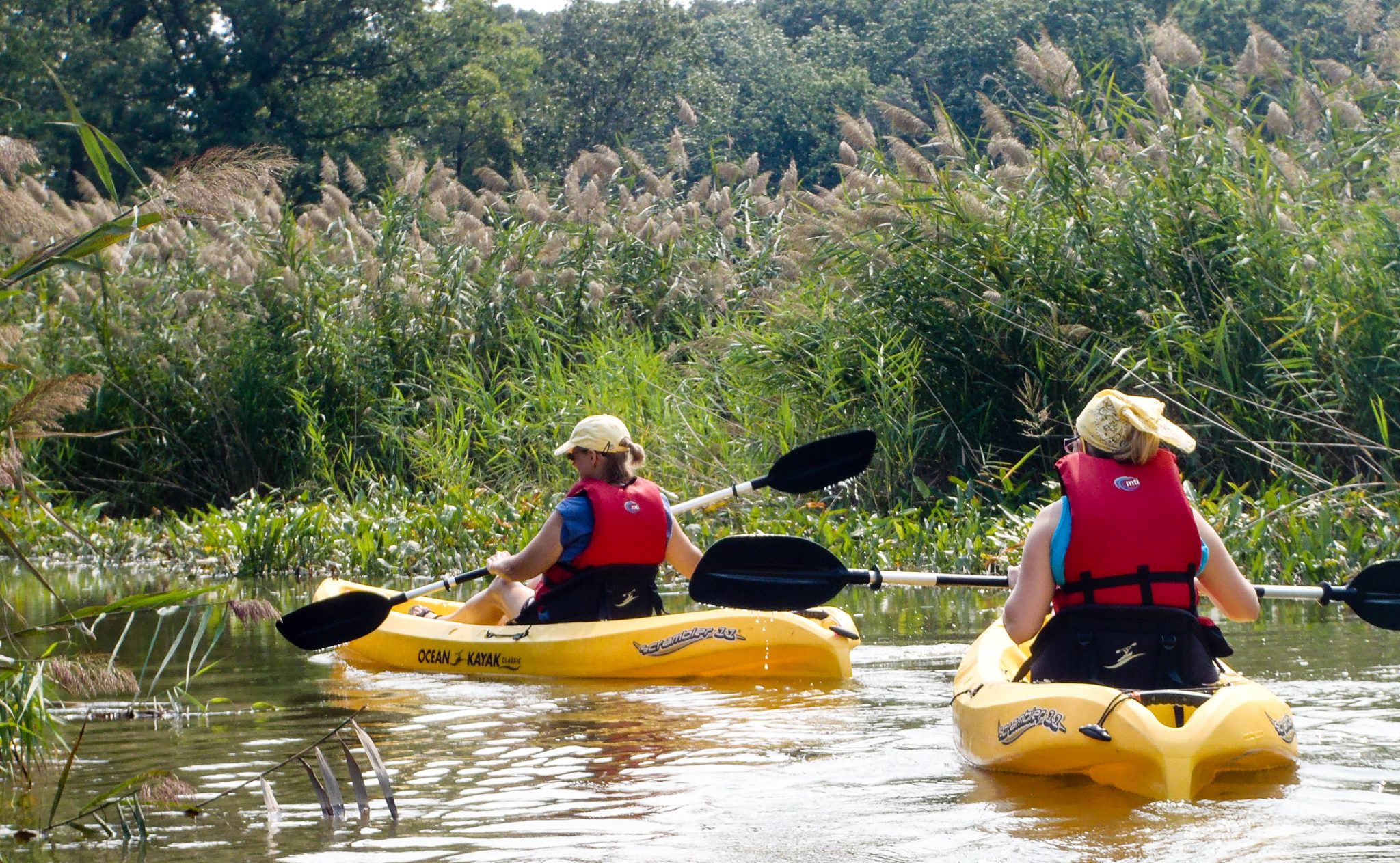
#8 Tuckahoe Creek (near Tuckahoe State Park*), Denton, MD
Put-in: Hillsboro Boat Access (Denton) / Take-out: Tuckahoe Landing (Easton)


Location: Hillsboro Boat Access, Main Street, Denton, MD 21629
Parking Coordinates: 38.917044, -75.944641
Parking: Limited, free
Distance: 11~ miles (or less if you prefer to go out and back)
Difficulty: Easy-Moderate (distance)
Synopsis: Tuckahoe Creek is a 21.5-mile-long tributary of the Choptank River on Maryland’s Eastern Shore. It is sometimes referred to as the Tuckahoe River. If you have more than one kayak-transporting vehicle with you, I suggest the put-in and take-out (noted above) so you’ll get to see the most of the Creek. Unload your kayaks at Hillsboro, and with both vehicles, relocate one to the take-out spot and return to Hillsboro to start the journey (also known as “shuttling”). There are sporadic stopping points on the Creek to have lunch, take a swim. There are no restrooms available during the paddle. The Creek snakes quite a bit, but you can’t get lost, since you’re only going one possible direction. If you rent kayaks from Denton (Ace) Hardware, keep in mind that you will need to transport them to/from the Creek and also return them on time (so start out early for this one)! Tuckahoe State Park to the north is a great place to car camp (and offers select dog-friendly and electric sites).
Fee: No fee
Further Details: DNR.gov (Bandana Map), Denton Hardware (Kayak Rentals, you must transport)
#9 Patapsco Valley State Park, Ellicott City, MD
Put-in: Daniels Area (Soft) Boat Launch


Location: 2090 Daniels Road, Ellicott City, MD 21043
Parking Coordinates: 39.313792, -76.815595
Parking: Limited, free (if the boat launch area is full, there’s more parking just around the bend)
Distance: Approximately 3.5 miles, out and back
Difficulty: Easy
Synopsis: This largely undeveloped area of Patapsco is enjoyed by paddlers, anglers, and hikers. Paddlers can enjoy this section of the Patapsco year-round. Water is backed up behind the dam to provide about 2 miles of flat water even during low water conditions. When the river is running high, paddlers can travel from Woodstock Road (Rt. 125) to the Daniels Area, approximately 4.7 river miles. The Daniels Area has a canoe put-in / take-out just above the dam. This is the perfect section of the park for a quiet afternoon walk or a morning paddle as the mist floats just above the river’s glassy surface. We have often spotted turtles here, just below the surface…when the water is clear (there hasn’t been rain recently to stir it up), make sure to keep an eye on the bottom. Once you’ve launched your kayak, proceed away from the dam and go approximately 1.75 miles until you reach a rocky patch. Just beyond the rocky patch (you’ll need some upper body strength to paddle through this), there’s usually a nice beach area for landing to the left.
Fee: No fee
Further Details: DNR.gov
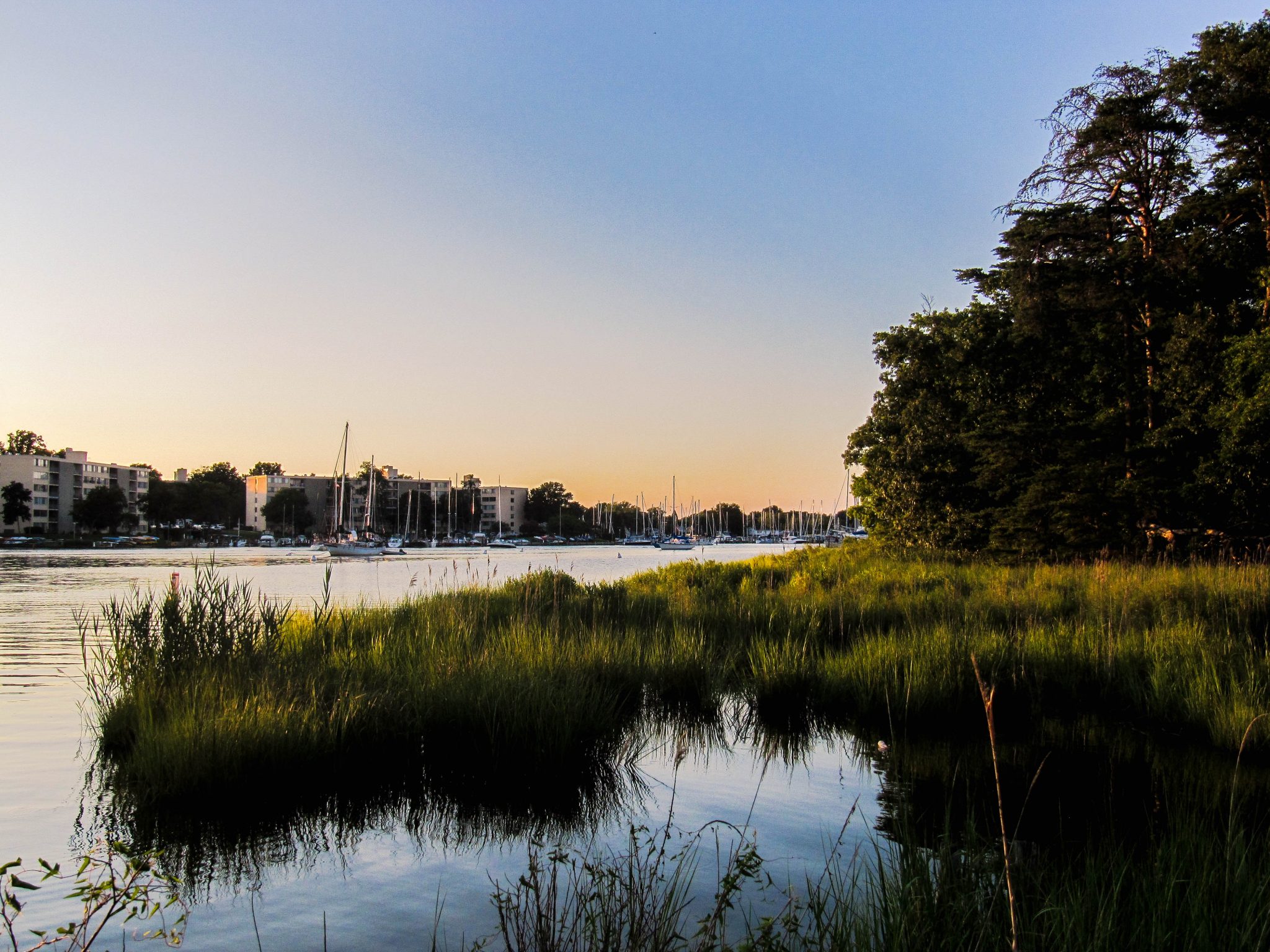
#10 Annapolis, Maryland
Put-in: Ellen O. Moyer Nature Park at Back Creek (Soft) Boat Launch
Location: 7314 Edgewood Road, Annapolis, MD 21403
Parking Coordinates: 38.960944, -76.480663
Parking: Limited, free
Distance: Varies
Difficulty: Moderate (chop)
Synopsis: Take Back Creek to the right, and approach and make a left onto the Severn River (to head towards downtown Annapolis). Paddle past Horn Point, cross the Annapolis Harbor, at the mouth of Spa Creek, and paddle up Ego Alley if you desire. And, then head back, as an out and back (approximately 3.5 miles roundtrip), or continue up Spa Creek further for added distance. An alternative trip is to take Back Creek to the right (from the put-in) and make a right onto the Severn River around Chinks Point (heading away from downtown Annapolis) as there’s a nice soft landing beach here to enjoy some R&R (approximately 2.5 miles roundtrip).
Fee: No fee
Further Details: AnnapolisBoating.org (Excursions), AnnapolisCanoeAndKayak.com (Kayak Rentals located at Third Street & Spa Creek, near the Annapolis Harbor)
#11 Gunpowder Falls State Park, Middle River, MD
Put-in: Hammerman Area (Soft) Boat Launch -or- Boat Ramp (Dundee Creek Marina Boat Ramp is also close too)
Important: This park occasionally closes to additional inbound traffic when it’s reached capacity at peak times. Learn more on the DNR website.
Location: 7200 Graces Quarters Road, Middle River, MD 21220
Parking Coordinates: 39.358757, -76.344059
Parking: Limited, free
Distance: Varies
Difficulty: Easy-Moderate (chop varies)
Synopsis: From the soft launch beach, to the right of the swimming beaches, or from the boat ramp, you can head either north or south on the Gunpowder River, veering off into small creeks on either side of the park beaches. Be sure to check the tide information before you head into one of these shallower areas. Roundtrip they are each about 2 miles. I have spotted snakeheads here and informed DNR with photos. Swimming is in designated areas only. Dundee Creek Marina also offers a boat launch on nearby Dundee Creek.
Fee: Nominal per person (in-state & out-of-state) day use DNR fee
Further Details: DNR.gov (Map)
On Land & Water
#1 Easton, MD
Easton – Oxford – St. Michaels Bike Loop
")
")
")
")
Location: Hayward Avenue, Easton, MD (adjacent to YMCA of Talbot County, 202 Peach Blossom Ln, Easton, MD 21601)
Parking Coordinates: 38.761573, -76.075321
Parking: Street parking, free
Type: Bike & ferry boat ride
Distance: 30~ miles
Difficulty: Easy (flat terrain, with rest every 10~ miles)
Synopsis: Enjoy nautical heritage and rural charm of Maryland’s Eastern Shore by bicycle. This loop begins in Easton, with an approximately 10-mile stretch to Oxford. Here, you’ll grab the next available Oxford Bellevue Ferry, believed to be the nation’s oldest privately operated ferry service. You’ll cross the Tred Avon River to arrive in Bellevue. In about 10 miles you’ll reach St. Michaels, which is a great pit stop for lunch, with its many quaint (and a handful of on-the-water) eateries. Following the second leg, it’s approximately 10 miles back to the starting location. Terrain is flat, paved, and accommodating to bicycles of all types.
Fee: $5/person cash “walk on” ferry fee (Ferry does not operate mid-November – mid-April and has limited service in opening & closing months of the year; last daily ride is before sunset)
Further Details: RideWithGPS.com
#2 Upper Marlboro, MD (PG County side of Jug Bay)
Jug Bay Wetlands Sanctuary “Surf ‘n Turf,” Patuxent River Park


Location: 16000 Croom Airport Rd, Upper Marlboro, MD 20772
Parking Coordinates: 38.773642, -76.71109
Parking: Plenty of it, free
Type: Hike & pontoon boat ride
Distance: 1~ mile (on foot)
Difficulty: Easy
Synopsis: The Jug Bay Wetlands Sanctuary, more than 1400 acres of quietly secluded tidal freshwater wetlands, is located along the tidal Patuxent River in southern Anne Arundel County (though the P.G. County side is recommended for this excursion), just 20 miles from either Washington D.C. or Annapolis. The wetlands, with large stands of aquatic plants, are home to many birds, fish, reptiles, and mammals. More than 250 species have been recorded here, including great blue herons, wood ducks, Canadian geese, and even bald eagles. Osprey sightings are all but guaranteed, thanks to the park’s nesting platforms. Inquire with the park directly or online events calendar to find out when they are offering one-hour river ecology pontoon boat tours paired with a one-hour guided wetland nature “hike” over forest trails, marshland boardwalk, river piers, and observation decks. The park has picnic tables overlooking the river.
Fee: Nominal per person hike / tour fees
Further Details: PGParks.com
Saving Amy is a participant in the Amazon Services LLC Associates Program, an affiliate advertising program designed to provide a means for sites to earn advertising fees by advertising and linking to amazon.com.
Photography Disclaimer
All photos in this post are property of this blog and/or various members of the Chesapeake Kayak Adventures Meetup group. Do not use these photos without written permission.
Fees, parking lot locations, rental information, was accurate at the time of original posting. Please research park websites for most up-to-date information.
Related:
- MapPedometer.com
- GPS-Coordinates.net
- Smart Device App: Tide Charts Near Me (iOS | Andriod)
- Geocaching.com